Touring region Wattental
The Wattental in the Tux Pre-Alps offers ideal ski touring terrain from the first snowfalls in December until spring. Accordingly, the influx is also - on beautiful weekends, parking spaces are often scarce and all slopes are crisscrossed with ski tracks.
In addition to the protection zones for forest and game, there are also restrictions due to the operation of the military training area of the Austrian Army.
Protected sites and wildlife
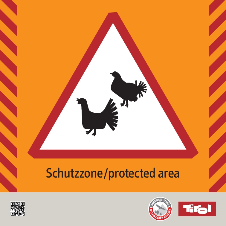
Based on the principles of the “Tyrolean Ski and Snowboard Tour Plan”, the partners to the “Wattental Touring Region” project have agreed on three subjects of protection. Mountaineers should voluntarily avoid the conservation areas protecting these sites.
The three subjects of protection are:
Digital Map
All relevant information for digital tour planning.
We strive to integrate information on forest and wildlife protection zones into the digital maps of commonly used tour planning platforms. OpenStreetMap (OSM) often serves as the base map for various outdoor apps. In OSM, the protection zones are available from a certain zoom level onwards.
Tip:
With TirisMobile, the Province of Tyrol offers an excellent tool for tour planning. All forest and wildlife protection zones agreed upon by the working group are available there.
Signage
Protected zones are only signposted in the field at locations where there is direct interaction with a ski touring route. Directional arrows that allow users to bypass or avoid these zones are also used very sparingly. In general, signage is limited to areas below the tree line.
The direction signs do not imply that the suggested routes are secured against avalanches or other natural hazards. Assessing these risks is the personal responsibility of ski tourers.
Military training ground Lizum-Walchen
In addition to the forest and wildlife protection zones, restricted areas apply in the military practice ground of the Lizum/Walchen for reasons of military security and due to dangers from live firing. Therefore, only the ski routes designated on the TÜPl map may be used. In addition, these routes may be temporarily closed during firing operations or when unexploded ordnance is encountered, in order to prevent danger to life from live firing. Failure to follow the designated routes may result in hazards and reports to the district administrative authority. The currently closed areas are posted daily at the info point at the entrance to the Walchen camp and at the Lizumer Hütte. Shooting days will be announced 1 week in advance to the municipality of Wattenberg and the PES. The ski routes may only be used when there is sufficient snow. Photography, filming, as well as any drawing is prohibited.
More detailed information about the closing times can be found here.
Panorama boards
In winter 21/22 panorama boards will be set up at the most important ski touring parking lots, showing the most famous ski tours and the protection zones for wildlife and forest. The vividly depicted 3D panoramas also provide information about the 3 subjects of protection and rules of conduct that are important when moving in alpine terrain to protect the forest and wildlife.
The info on emergency equipment, the emergency APP and the link to the avalanche situation report come from our partner the Mountain Rescue Tyrol.
Skitouren im Wattental
The “Wattental Ski Tour Region” working party
With the Tyrolean Ski and Snowboard Tour Plan, it has been particularly important to us that all stakeholders should have an equal say about all measures and be able to voice their concerns. In the Wattental working party we have so far been very successful in achieving this and hope that, by virtue of the wide range of stakeholders, all interests have been considered in a balanced way.
The following are represented in the working group
- Community of Wattenberg
- Landowners
- Austrian Federal Forests (ÖBf AG)
- Austrian Armed Forces (TÜPL Lizum - Walchen)
- Association LEWAL (Lebenswertes Wattental)
- Alpine club, local tourers
- Tourism Association Hall-Wattens
- Hunters
- Forestry authority
- Administration Province of Tyrol

Contact:
Klaus Pietersteiner
Province of Tyrol - Department for Forestry Conservation
Bürgerstr. 36, 6020 Innsbruck
klaus.pietersteiner@tirol.gv.at
Tel.: +43 512 508 4605


![[Translate to English:] Kartenausschnitt Wattental von TirisMobile © Land Tirol [Translate to English:]](/fileadmin/userdaten/Lokale_Projekte/Wattental/Tirismobile_Wattental_Schutzzonen.png)
![[Translate to English:] Skitourengeher informieren sich über Wild- und Waldschutzzonen © Land Tirol [Translate to English:]](/fileadmin/userdaten/Lokale_Projekte/Wattental/_S5D2347.jpg)


